Click On Image
For Full Size Image | Size |
Image Description |
Source |

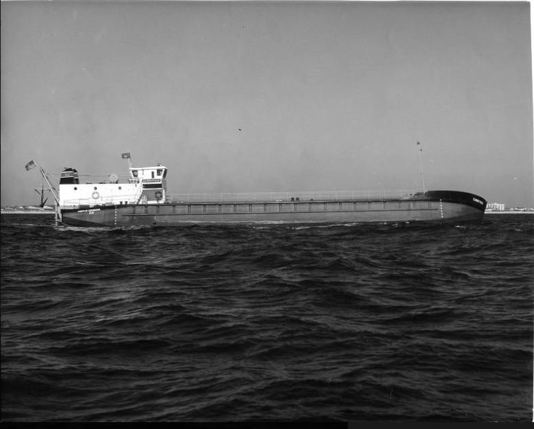
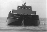
30260411 |
57k |
USACE Currituck (II) underway off Virginia Beach, VA., date unknown.
U.S. Army Corps of Engineers Digital Library |
|
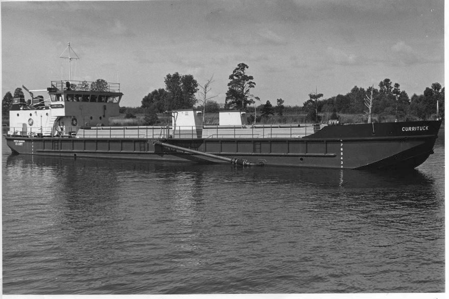
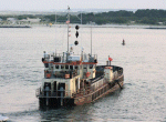
30260412 |
105k |
USACE Dredge Currituck (II) underway, location unknown, circa 1977.
U.S. Army Corps of Engineers Digital Library |
|
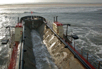
30260413 |
43k |
USACE Dredge Currituck (II) bow on view of spilt hull dumping dredged material at sea, date and location unknown.
U.S. Army Corps of Engineers Digital Library |
|

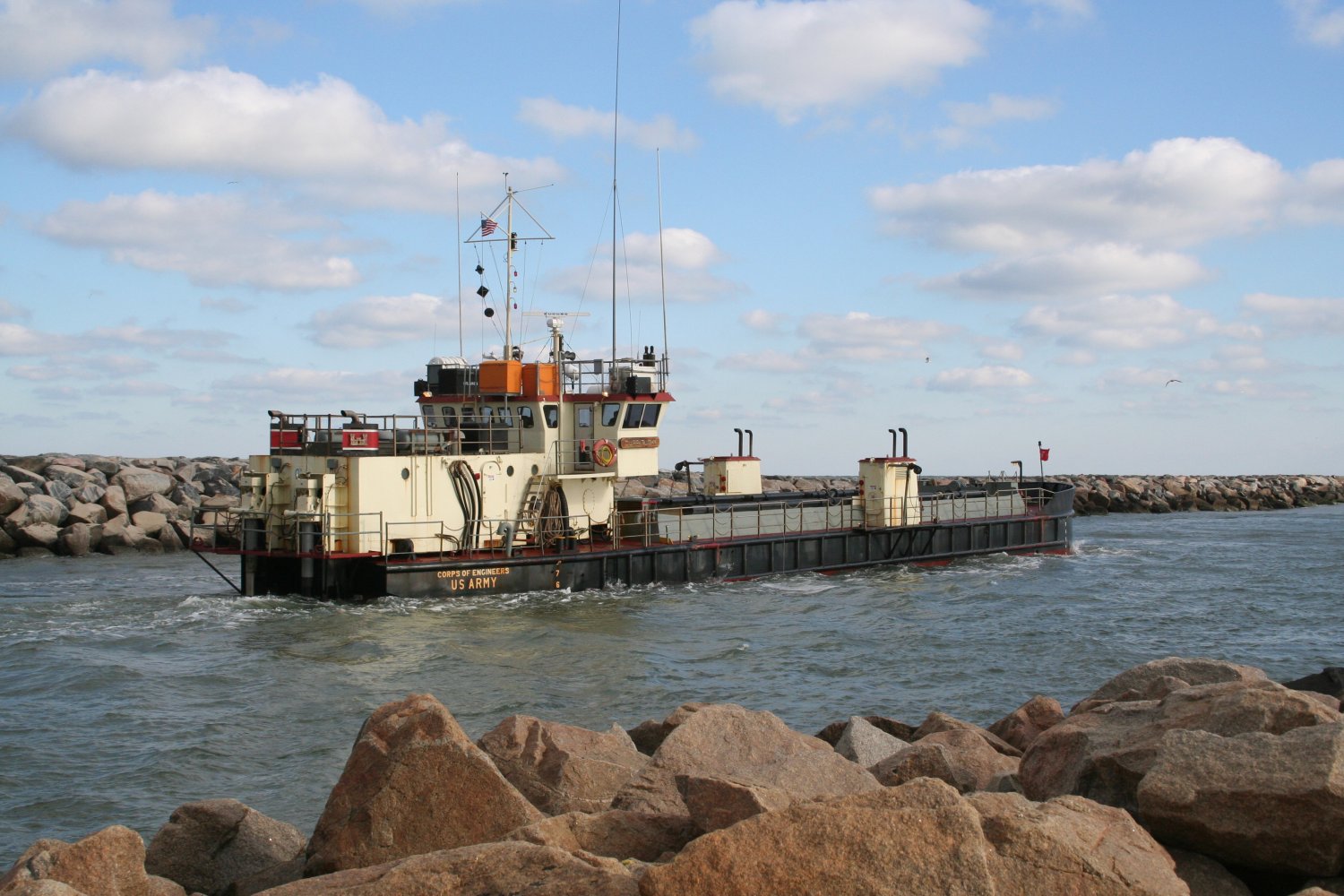
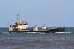
30260402 |
242k |
USACE Dredge Currituck (II) in Rudee Inlet, 29 January 2012, to dredge within the federal navigation channel. Currituck
dredged the shoaling across the channel to maintain the channel depth at 10-feet. The shoal had caused depths as shallow as seven feet in some areas. Currituck,
one of the Corps' dredges, is a highly utilized resource throughout coastal projects along the East Coast. During this project, approximately 25,000 cubic yards was
dredged. The Wilmington, NC-based Currituck will return to Virginia in April to dredge anticipated shoaling in the channel. Rudee Inlet is considered an
extremely dynamic tidal inlet and requires regular maintenance dredging.
U.S. Army Corps of Engineers Photo # 051213-A-OI229-002,by Patrick Bloodgood |
Tommy Trampp |
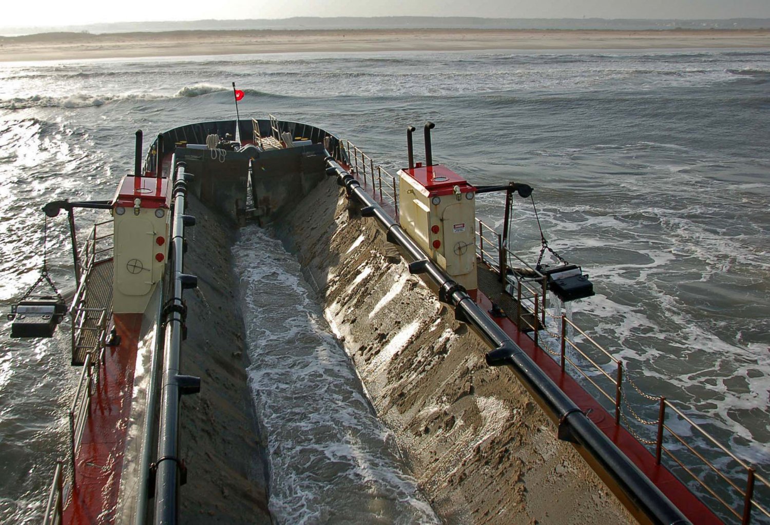
30260408 |
253k |
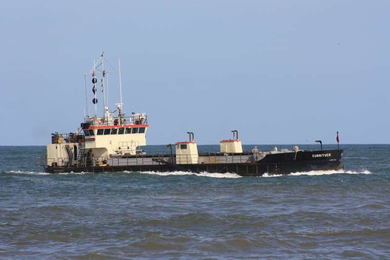
Shallow draft, special purpose vessel USACE Currituck (II) is homeported in Wilmington, N.C., but it spends most of its time helping fellow
USACE districts from Maine to Florida. Here she is removing material from the federal channel in the harbor at Ocean City, MD., 10 April 2011 That material is then taken in this split
hull dredge to the National Park Service's Assateague Island National Seashore to replace material that naturally erodes away. Because of its unique capabilities as a shallow draft
vessel Currituck can deposit the material in six feet of water. This gives the beach a more natural look, and eliminates the need for pipeline dredging which disturbs
various species of protected wildlife.
US Army Corp of Engineers Photo # 110410-A-IM544-001 by Hank Heusinkveld |
Tommy Trampp |
30260409 |
389k |
USACE Currituck (II) takes a full load of material dredged from the harbor at Ocean City, MD. to the shore of Assateague Island.
The Currituck's shallow draft capabilities allow it to unload material in six of water. This creates a more natural look along the shoreline and helps to reduce erosion
US Army Corp of Engineers Photo # 110410-A-IM544-004 by Hank Heusinkveld |
Tommy Trampp |

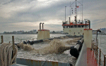
30260410 |
315k |
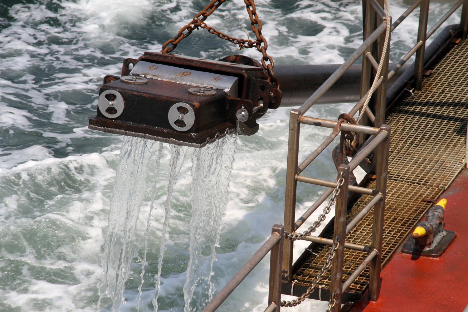
USACE Currituck's Captain, Martin Willis, prepares to drop one drag arm into Bennett’s Creek, Suffolk, VA., to start dredging 23 April 2013.
Operating much like a giant vacuum cleaner, the vessel's drag arms hang from each side and are lowered into the channel. Each drag arms sucks a water and sand mixture, known as
slurry, from the channel bottom. The slurry then passes through the drag heads and pipelines into the hopper the dredge. Currituck arrived at Bennett’s Creek 20 April 2013
to remove approximately 4,000 cubic yards of sand to increase the channel depth from 2 feet to 6 feet
US Army Corp of Engineers Photo # by Pamela K Spaugy |
Tommy Trampp |
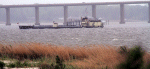
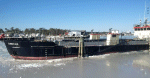
30260401 |
107k |
USACE Dredge Currituck (II) in Bennett’s Creek, 24 April 2013, to remove shoaling in the federal navigation channel. The Wilmington, N.C.-based
dredge will remove 4,000 cubic yards of sand -- the result of shoaling caused by natural transport and deposit of sediment. The shoaling, which was exacerbated by
Hurricane Sandy, presents both safety and economic impacts for the maritime industry and nation. The dredging will increase the depth from 2 to 6 feet in half of the
60-foot channel.
U.S. Army Corps of Engineers Norfolk District. Photo # 130422-A-ON889-020, by /Pamela Spaugy. |
Robert Hurst |
30260403 |
34k |
USACE Dredge Currituck (II) underway, date and location unknown
U.S. Army Corps of Engineers Photo |
Dredgepoint-US Army Corps of Engineers |
30260404 |
61k |
30260407 |
157k |
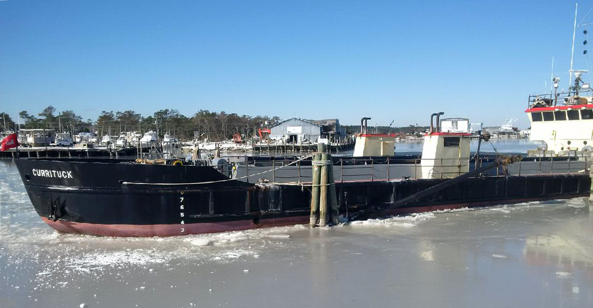
USACE Dredge Currituck (II) remains in place after being frozen in at a dock in Wanchese Harbor in North Carolina's Outer Banks, 8 January 2018.
US Army Corp of Engineers Photo # 180108-A-IM544-001 by Joen Petersen |
Tommy Trampp |
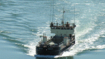
30260406 |
257k |
USACE Dredge Currituck (II) underway, date and location unknown
US Army Corp of Engineers Wilmington District photo |
Tommy Trampp |