NavSource Online: Army Ship Photo Archive

Please report any broken links or trouble you might come across to the Webmaster. Please take a moment to let us know so that we can correct any problems and make your visit as enjoyable and as informative as possible.
| Click On Image For Full Size Image | Size | Image Description | Source | |
|---|---|---|---|---|

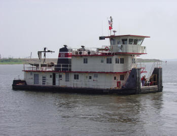
303000704 |
266k | Photo - Tenn-Tom Waterway, location unknown Map - Tenn-Tom Waterway |
Tommy Trampp | |

303000701 |
224k | USACE Towboat Tenn-Tom moored with US Army Corps of work boat Constitution alongside.
US Army Corps of Engineers photo |
US Army Corps of Engineers | |

303000702 |
173k | USACE Towboat Tenn-Tom underway, date and location unknown.
US Army Corps of Engineers photo |
US Army Corps of Engineers | |
303000703 |
15k | USACE Towboat Tenn-Tom underway, date and location unknown.
US Army Corps of Engineers photo |
Tommy Trampp | |

3028002703 |
50k | USACE Towboat Tenn-Tom pushing USACE Floating
Crane R. W. Davis, date and location unknown.
US Army Corps of Engineers Mobile District photos |
Tommy Trampp | |
| Back To The Navsource Photo Archives Main Page | Back To The US Army Ship Index | Back To The US Army Towboat Index |
| Comments, Suggestions, E-mail Webmaster. |
|
This page is created and maintained by Gary P. Priolo |